Flying From High Pressure to Low Pressure Explained
Aug 11, 2026
Flying from high pressure to low pressure can cause dangerous altimeter errors that put pilots at risk of flying lower than indicated. Understanding how atmospheric pressure changes affect your instruments and flight safety is crucial. Learn why updating your altimeter is vital and how to navigate these pressure systems safely.
Quick Answer: What Happens When You Fly from High Pressure to Low Pressure?
Flying from high pressure into low pressure without switching your altimeter setting over is a recipe for disaster your aircraft altimeter starts off telling you you're way higher up than you actually are. And that's not a surprise high to low, it's a classic reminder: look out below!
To drive that point home, imagine you're heading east from Denver, where the skies are bright and clear under a mighty high pressure system with a reading of 30.42 inHg on 12 January 2025. Then you find yourself heading into Kansas City where the air is a lot thinner and the pressure is down at 29.62 inHg - a whopping 0.80 inHg difference.
That's equivalent to being a whole 800 feet lower than your altimeter is telling you, so if you think you're cruising along at 8,000 feet, the reality is you're really somewhere around 7,200 feet above sea level.
This is a separate issue to the cold temperature errors that can also throw your altimeter readings for a loop both come down to the fact that your altimeter is measuring air pressure, not how high up your aircraft is.
To avoid getting caught out and staying safe:
-
Make sure you get hold of the most up to date altimeter settings you can grab a METAR, ATIS or air traffic control briefing along the route you're taking.
-
Reset the Kollsman window at least every 100 nm when you're below 18,000 feet, it's worth the extra bit of work.
-
Think extra careful about terrain and obstacle clearance when you're crossing some of those big pressure gradients especially at night or when visibility is reduced.
Fundamentals of Atmospheric and Barometric Pressure
Atmospheric pressure is the weight that the air above you exerts on the ground it's basically the weight of all the air stacked up from sea level right on down. And here's the thing the higher up you go, the less air sits on top of you, and that's why pressure simply drops off.
Air is always moving from areas where it's a bit too thick to areas where it's a bit too thin, which no surprise is what drives wind and weather changes. In the States we measure barometric pressure in inches of mercury (using a barometer, of course), while pilots the world over use hectopascals (or millibars - we've all got different ways of doing things).
And as you'd expect, standard sea level pressure is 29.92 inches of mercury. That's same as 1013.25 hectopascals if you're a pilot. High & low pressure it's all relative. What one high-pressure system over the Midwest might be a whopping 30.70 inHg, another low-pressured system over the Atlantic might drop down to a paltry 28.80 inHg. As a pilot though, what really matters is the difference between those values along that flight route of yours.
The altimeter's based on a standard pressure-altitude relationship - that's according to the International Standard Atmosphere, or ISA. But when things in real life don't quite match that model, that's when errors start creeping in.
Large-scale pressure systems (and you can see them on surface analysis charts as ridges and troughs) are what create the overall weather conditions and in flight how your altimeter is gonna behave.
How the Altimeter Uses Air Pressure (and Why Pressure Changes Matter)
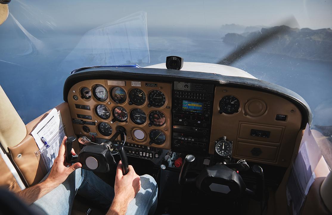
An aircraft altimeter is basically a barometer but its fundamentally been tweaked to show altitude instead. It calculates the difference between the air pressure outside the plane and a pressure we call the reference point a setting you get to choose, depending on what you want to know.
Inside a mechanical altimeter, there's a set of special metal discs that are sealed pretty tight "aneroid wafers" they're called. You feed air pressure into these discs through the static air ports on the plane.
When the air outside gets thinner (as you go higher up), they start to expand which makes the gears & needles move and show a higher altitude on the screen. & They do the opposite when the air gets thicker lower down. They're set up so that they think standard sea level is 29.92 inches of mercury.
When the Kollsman window is set to 29.92 inHg, what you get is the pressure altitude - that's the reading on the altimeter. This is used as the basis for flight level assignments - in the States, we use FL180 as the transition altitude and after that, every plane uses the same standard, so vertical separation is easier to rely on.
Modern glass cockpit systems use an Air Data Computer (ADC) to sense barometric pressure electronically and compute altitude digitally for the Primary Flight Display. Despite the technology upgrade, these systems rely on the same pressure-altitude assumptions and are subject to the same errors as mechanical instruments.
To ensure these systems continue providing accurate altitude information for IFR operations, pilots should also understand the inspection and testing requirements of FAR 91.411.
The altimeter displays indicated altitude, which matches true altitude only when both the correct setting for local barometric pressure and standard temperature are present. Even a 0.10 inHg error equals roughly 100 feet of altitude error. A one-inch error in altimeter setting equals 1,000 feet of altitude difference-a margin that can be fatal near terrain.
The Rule: "High to Low, Look Out Below" Explained
Every instrument flying handbook beats into student pilots: "From high to low (pressure or temperature), watch out stuff's about to get real down there."
Here's the lowdown step by step: when you set your altimeter at your departure airport, and then fly into a low pressure area without updating to the correct setting, the altimeter still thinks the higher reference pressure from where you departed is in play. This is a common example of how a wrong altimeter setting can cause your indicated altitude to be higher than your true altitude.
A drop in ambient pressure happens when you fly into low-pressure systems, but the instrument can't be bothered to catch on. The pressure levels the altimeter tracks just go with the flow in the low-pressure region, so your plane starts to descend along with them. Your altimeter still shows the same indicated altitude, but your actual altitude is dropping like a stone.
Flying from high to low pressure can get you in a whole heap of trouble, with altitude errors putting you perilously close to the ground.
Example 1: Depart a field with altimeter setting 30.35 inHg and cruise into an area where the actual pressure is 29.85 inHg. The 0.50 inHg difference equals approximately 500 feet of error. If your altimeter shows 5,000 feet, your true altitude is closer to 4,500 feet.
Example 2: Cross a strong autumn front in the Great Lakes region where surface pressure drops from 30.10 inHg near Chicago to 29.40 inHg over Cleveland. That 0.70 inHg difference creates roughly 700 feet of error-enough to violate minimum descent altitude on an approach.
The reverse effect also exists. Flying from low to high pressure without correction makes true altitude higher than indicated. Less dangerous for terrain clearance, but still a separation and procedure concern.
Operational Hazards When Crossing Pressure Systems
Picture a night IFR flight in January from Fargo to Duluth, crossing a deep low-pressure system with rapidly falling barometric pressure. You departed with the altimeter set to 30.15 inHg. Over the next 200 NM, pressure drops to 29.35 inHg. Without updates, you are now 800 feet lower than your altimeter indicates-in clouds, over terrain, at night.
Key hazards of uncorrected altimeter settings when moving from high to low pressure:
-
Reduced terrain and obstacle clearance, especially in mountainous areas like the Rockies or Appalachians.
-
Risk of descending below published IFR minimum altitudes (MDA/DA, MEA, MOCA) without realizing it.
-
Loss of vertical separation from other IFR traffic flying on properly set altimeters or standard pressure flight levels.
Low-pressure systems often create challenging conditions for pilots. Steep pressure gradients-common around fast-moving cold fronts and along the Aleutians-can produce pressure changes of 1.00 inHg over 150 NM.
Pilots operating under visual flight rules should also understand VFR Flight Minimums, since deteriorating weather and reduced visibility associated with these systems can quickly affect whether VFR operations remain legal and safe.
Safety data confirms the scope of the problem. In one analysis of 626 level-bust reports, 68 events (roughly 11%) involved altimeter mis-settings, with low barometric pressure being a factor in nearly two-thirds of those. ASRS reports describe multiple near-CFIT events where crews did not update rapidly falling altimeter settings during storms with low barometric pressure near 28.90 inHg.
On a surface analysis chart, tightly packed isobars signal steep gradients and higher risk of significant in-flight pressure changes.
Altimeter Setting Procedures: Below and Above FL180
Standardized altimeter settings are a must because its the only way to make sure every aircraft in the air is using the same pressure reference so vertical separation works like clockwork. With modern flight procedures, you'll need to update your altimeters fairly often to avoid altitude confusion.
Below 18,000ft MSL in North America:
-
First job is to set your altimeter to the current altimeter setting (QNH), which you can get from a METAR, ATIS, AWOS/ASOS, Flight Service Station or air traffic control.
-
Altimeter settings need to be updated from a nearby station every 100 nautical miles or as told by ATC - especially if you're crossing over a weather system.
At and above FL180:
-
At this height, your altimeters are set to standard pressure of 29.92 inches of mercury (or 1013 hpa) and you're flying at a flight level (FL190, FL200 etc.)
-
But be careful - you need to switch back to local QNH when descending and forgetting to do this is a pretty common error that can catch you out especially if there's a really deep low-pressure system below.
When the barometric pressure goes up above 31.00 inches, the FAA starts to get a bit more strict about altimetry sometimes telling pilots to keep their altimeter set to 31.00 till final approach.
And then there's the international side of things different countries have different rules for example some European countries have a transition altitude of around 5000-7000ft while its a mere 3000ft near Buenos Aires in South America.
And then there's the unit thing too inches of mercury versus hPa can catch out pilots who aren't used to working in a different system
Before you make your way down through changing pressure areas: grab the latest altimeter setting, make sure you've got the units right, set both altimeters if you have them, double-check the readings and then remind everyone in the cockpit what's going on.
Cold Temperatures, Pressure Altitude, and Combined Errors
Aircraft altimeters rely on standard temperature and standard pressure conditions but when you fly into cold air that's colder than standard, true altitude ends up being lower than the altimeter is showing and that's on top of the problem that already exists when you fly into low pressure conditions.
Say you're flying from say Texas into northern Minnesota in January that's a double whammy for your altitude right there. Cold air reduces your performance and cold air also makes the air pressure drop.
Lower air density in these conditions gives you less lift to play with, and less performance from your engine too so now you're flying in a very high risk environment.
There are two inter-related but distinct ideas at play here:
-
Pressure altitude is what your altimeter is telling you it's the aircrafts height above sea level (or more accurately, the standard datum plane, which is 29.92 inHg) this is what your altimeter will tell you when you set it to standard conditions.
-
Density altitude is the pressure altitude, but it's been adjusted for non-standard temperature and it's more of a performance issue than an altitude issue and you won't find it as a value on your altimeter.
When flying under IFR conditions the FAA and Transport Canada give out tables for correcting for cold temperatures and they designate airports that are cold temperature restricted. When it gets really cold at an airport like Yellowknife say to -35°C on a very cold morning you have to make huge corrections to your minimum altitude when you're on an instrument approach and it can be over 1,000 feet.
The thing is pilots have got to manually work out the cold temperature corrections to minimum altitudes - because there is no direct way to adjust your altimeter for temperature like there is for barometric pressure.
So before you even get in the plane pre-flight checks are absolutely crucial when you know you are going to be flying through frost and icing conditions and you've got to figure out your approach altitudes before you start the procedure.
Practical Techniques to Manage Air Pressure Changes in Flight
Understanding the theory is important but what really keeps you safe is making pressure awareness a habit in your flying routine. Pilots need to keep their altimeter bang up to date when moving between different pressure systems & that means regularly updating it. Here's how to make it second nature.
Build updates into your flow. Make checking altimeter settings a regular part of your pre-set cruise routine every 30 minutes or whenever you change frequency. When you move on to a new air traffic control sector, double check that you've got the latest altimeter setting.
Cross-check altitude sources. check your indicated altitude against what your GPS is showing you and take note of the TAWS terrain warnings. Remember GPS is not perfect it introduces its own errors due to differences between the geoid & the ellipsoid. But a discrepancy of 500 feet or more between your GPS and barometric readings is something you need to look into.
Watch for tight isobars. When you're flying over a strong pressure gradient it's worth asking ATC to update your altimeter settings even if they don't offer. Keep an eye on METARs and TAFs for any changing weather conditions along your route using any of the weather tools you have at your disposal like ADS-B In weather, SiriusXM or your EFB apps with graphical METAR overlays.
Add buffer altitude. When you're flying at night or instrument conditions in mountainous terrain with known strong low pressure systems around, think about adding an extra 500 to 1000 feet above your MEA or MORA as an extra safety margin.
Consider this : a pilot departing westbound into a deep low over the Pacific Northwest sees surface pressure going below 29.00 inHg along the planned route.
Rather than pushing through the worst of it, the pilot adjusts the route to stay south of the system's core reducing the pressure change and the exposure to bad weather & reduced visibility. That's a solid aeronautical judgment.
